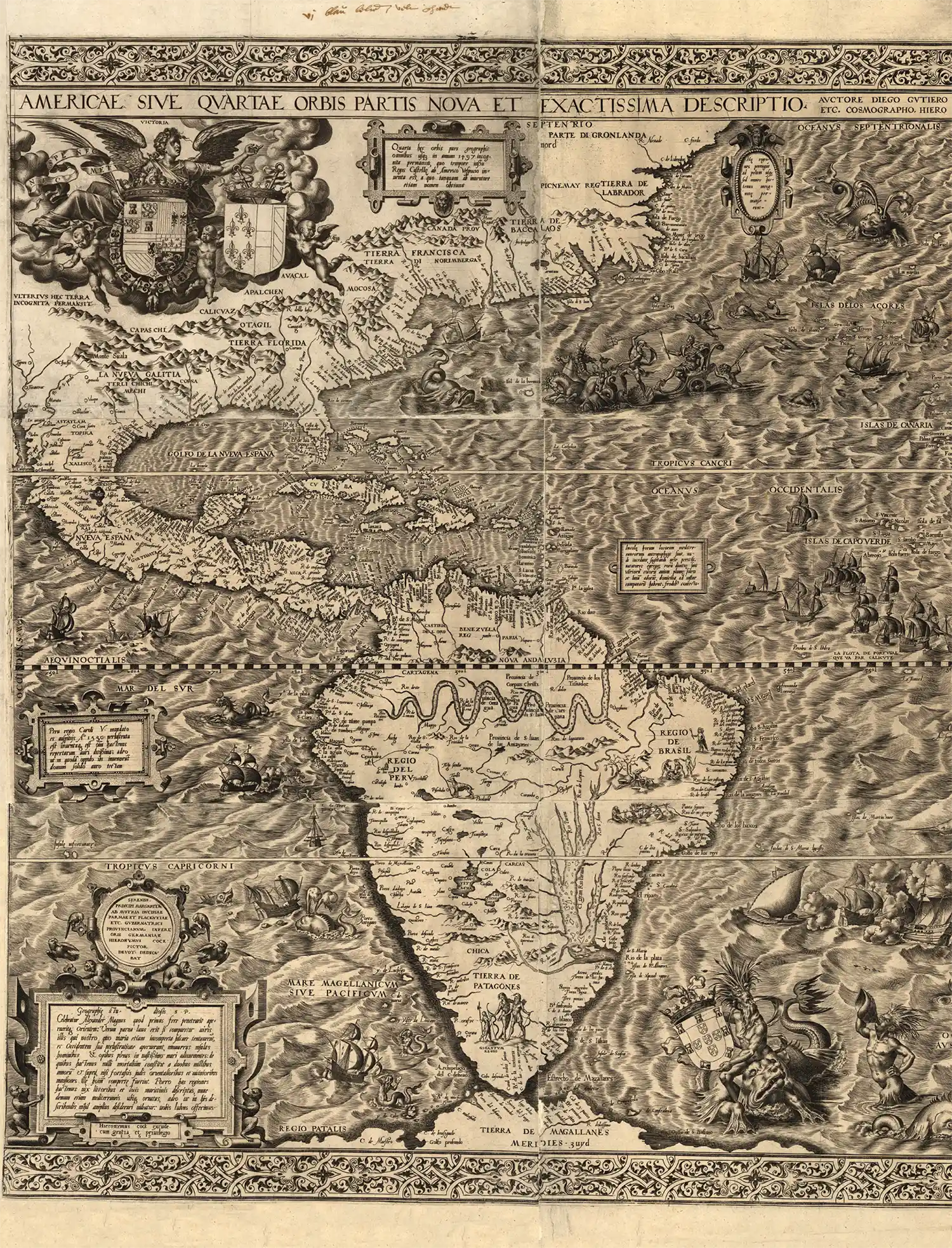
Putting California on the map
At that time in Europe, authoritative knowledge of the New World’s geography was based upon the observations of primarily Spanish- and Portuguese-sponsored expeditions that crossed the Atlantic to explore uncharted places.
The information they acquired was vital to Spain’s status as a world power. After all, the Spanish could better claim an empire if they could show these new territories on a map.
In 1562, Diego Gutiérrez, the principal cosmographer to King Philip II of Spain, created a map of the Western Hemisphere to serve that purpose.
Gutiérrez’s map spreads across six sheets that, when joined, measure 36 by 33 inches. Only two copies are known to exist: One at the Library of Congress, another at the British Library.

The map was engraved by Hieronymus Cock of Antwerp, one of the most important engravers and printmakers of 16th-century Europe. Cock added numerous artistic flourishes — monkeys, mermaids, fearsome sea creatures, cannibals, Patagonian giants, an erupting volcano — to complement the settlements, rivers, mountains and capes named.
The map correctly recognizes the Amazon River system, Lake Titicaca, Mexico City, Florida and the southeastern portion of the present-day United States, as well as myriad coastal features of North, South and Central America and the Caribbean.
Squeezed in at the left edge, just above the Tropic of Cancer, Gutiérrez added something new: “C. California” — the first time the name “California” appears on a printed map.
To claim an empire, one must show that it exists and to whom it belongs. With this map, Spain and Gutiérrez did just that.
MORE INFORMATION
Gutierrez’s New World map
loc.gov/resource/g3290.ct000342/