Bringing New Details to Light
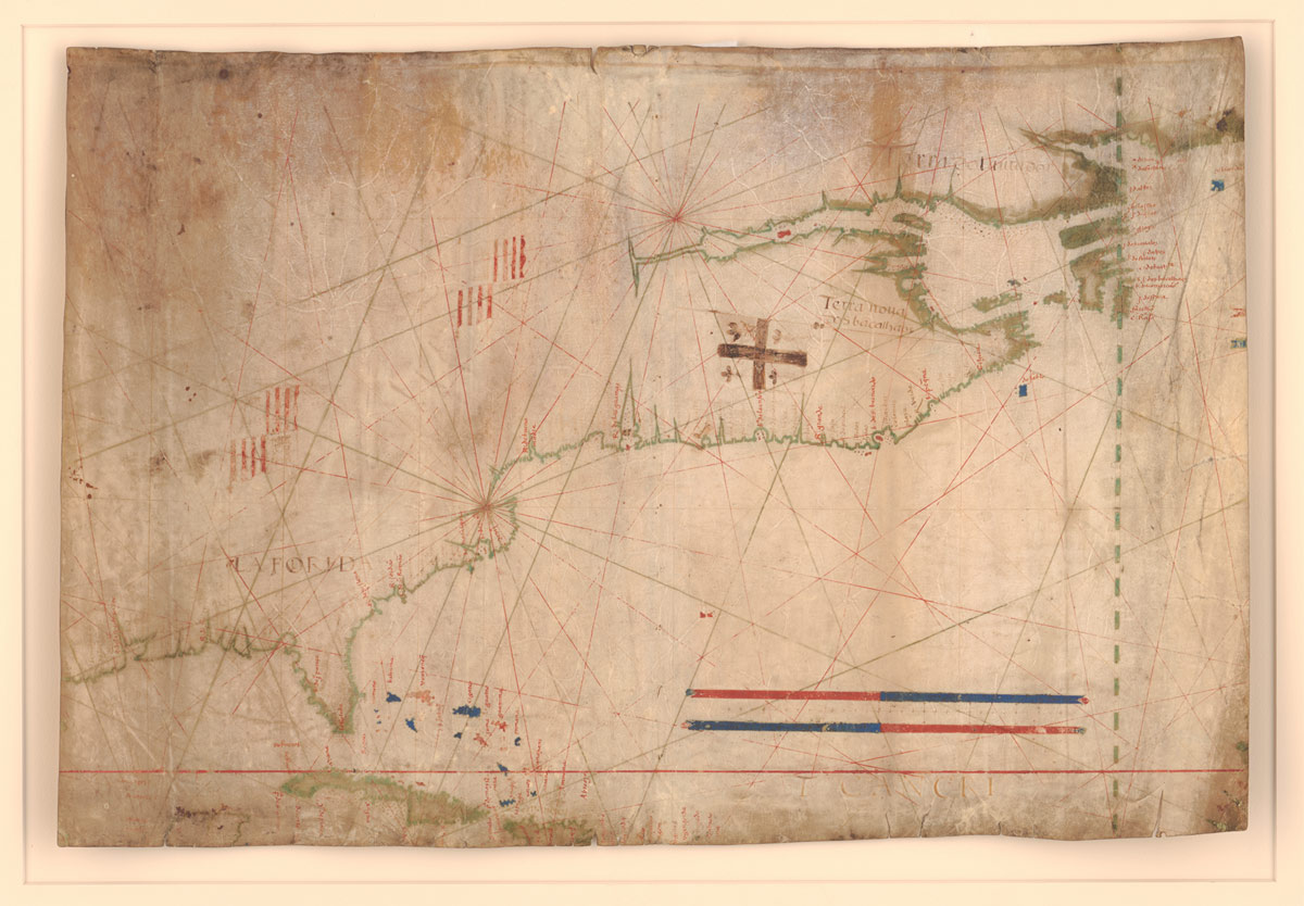
Portuguese cartographer Bartolomeu Velho created the map — an early nautical chart, or portolan — around 1560, and the Library acquired it last year. It is one of a small group of portolans depicting the East Coast of North America known to exist.
The Velho portolan came to the Library by a circuitous route, to say the least. It was found in 1961 at Rye Castle Museum in Sussex, England. By then, however, the portolan no longer was intact: It had been cut into quarters and repurposed for its vellum, or animal skin.
The segment purchased by the Library — the upper-left quadrant — was used to bind a 17th-century English manuscript before being identified as a portolan and separated from the book. The Rye Castle Museum holds another quadrant. The fate of the other two is unknown.
Easy accessibility to such a rare item is a boon for scholarship. The Library, however, went beyond simply making a digitized version available on its website.
Alongside the original, researchers also can access a high-resolution, enhanced version that reveals previously illegible place names — including some of the earliest known names for locations on the Atlantic coast.
They can do so thanks to a collaboration between the Library’s Geography and Map Division and the Preservation Research and Testing Division (PRTD).


For more than 15 years, PRTD has used noninvasive techniques, chief among them multispectral imaging, on collection items to glean information invisible to the human eye. Multispectral imaging involves digitally photographing an object at multiple wavelengths.
Through imaging and subsequent processing of the data it generates, specialists can obtain information about inks or colorants used in an object, for example, or detect a watermark that helps to date it. In some cases, an ink may almost melt away, revealing another ink below.
To elicit more information, the team draws on techniques that complement multispectral imaging. Infrared analysis provides data about an item’s substrate — parchment, for example. Reflectance spectroscopy brings forth details about color components within the visible spectrum, including plant-based materials. X-ray fluorescence spectroscopy offers information about trace metals in pigments, such as copper, iron or mercury.
The processes are noninvasive, requiring no physical sampling or, for the most part, contact between instruments and objects.
The information uncovered from maps adds to understanding of how they were created and of the cartographic practices of a period. With the Velho portolan, PRTD brought forward not only place names that had been illegible, but a scale, numbers and flags of European claimants to regions. Scholars mine such details. Place names, for example, can be used for dating and can verify that people inhabited a certain location at a certain time.
Library scientists hope the portolan is just the first example of enhanced images to be shared online — using innovative means to make collections more accessible.
MORE INFORMATION
The Velho portolan
loc.gov/item/2023586398/
